YOUR RESEARCH, YOUR ARCHIVES
Map Collection › Map Guide
Year | Dis. | L.L. | Made By: | Made For: | Size | Scale | Abstract |
1730.1.0.0 | Entire | State | Marion R. Hemperly c.1932 | Georgia D.O.T. | 14.5"x 17'' | 1 in. = 20 miles | Georgia, Early roads and trails 1730-1850 |
1748.1.0.0 | N/A | N/A | unknown | unknown | 14"x19" | unknown | Georgia, The Gulf Coast and the Lower Mississippi, 1748 |
1800.1.0.0 | 18th & 6th | N/A | Perkins, Brown in 1995 | Dunwoody Homeowners Association | 11"x17" | 1.8 in. = 1 mile | Hand drawn recreation of Hightower Indian Trail, overlayed onto 1995 road map |
1800.1.2.0 | 18th & 6th | N/A | Perkins, Brown in 1995 | Dunwoody Homeowners Association | 11"x17" | 1.8 in. = 1 mile | Hand drawn recreation of Hightower Indian Trail, overlayed onto 1995 road map |
1800.1.1.1 | 18th & 6th | N/A | Perkins, Brown in 1995 | Dunwoody Homeowners Association | 11"x17" | 1.8 in. = 1 mile | Hand drawn recreation of Hightower Indian Trail, overlayed onto 1995 road map |
1800.1.1.2 | 18th & 6th | N/A | Perkins, Brown in 1995 | Dunwoody Homeowners Association | 11"x17" | 1.8 in. = 1 mile | Hand drawn recreation of Hightower Indian Trail, overlayed onto 1995 road map |
1800.2.0.0 | North Half | of GA | John H. Goff | unknown | 11"x17" | 1 in. = 20 miles | Early Indian trails overlayed onto modern county base map |
1805U.1.0.0 | NW GA | N/A | unknown | unknown | 40"x22" | unknown | Northwest GA, including DeKalb County 1805-1818 (exact date unknown), map mounted on foamboard |
1805.2.0.0 | SW GA | N/A | unknown | unknown | 40"x22" | unknown | Southwest Georgia, including the confluence of the Flint River and the Chattahoochie River into the Gulf of Mexico |
1805.3.0.0 | DeKalb | N/A | unknown | unknown | 14"x10" | unknown | Eventual DeKalb County and surrounding area (pre-1820s) |
1811.1.0.0 | North GA | N/A | unknown | unknown | 15"x17" | unknown | North Georgia, eastern counties, western Indian territory (1811-1818) |
1821.1.0.0 | 15th | All | John Kell | State of GA | 19"x24" | 40 chains = 1 in. | Entire 15th district in 1821, Henry County |
1821.2.0.0 | Entire | State | unknown | unknown | 8.5"x11" | 1 in. = 35 miles | Entire state of Georgia, showing Henry County before the formation of DeKalb, shows all counties as of 1821. Mounted |
1839.1.0.0 | Entire | State | J. Knight | unknown | 10.5"x 13" | 1 in. = 25 miles | Entire State of Georgia, showing all counties as of 1839, shows roads, canals, steamboat routes, and mines. Mounted |
1861.1.0.0 | Entire | State | J. Harmon Smith (1961) | Dept. of Commerce | 24"x30" | 1 in. = 15 miles | Military action in the state of Georgia during the Civil War (1861-1864). Mounted |
1864.1.0.0 | DeKalb Co. | N/A | unknown | unknown | 18"x30" | 5/8 in. = 1 mile | No Civil War information, county base map |
1864.2.0.0 | Fulton & DeKalb | N/A | Wilbur G. Kurtz | Atlanta Historical Society | 19"x23" | 1.5 in. = 1 mile | Civil War battles around Atlanta, summer of 1864, recreated by Wilbur Kurtz in 1938. |
1864.3.0.0 | Fulton & DeKalb | N/A | GA D.O.T. | Civil War Centennial | 36"x24" | 2.5 in. = 1 mile | Battle of Peachtree Creek, Battle of Atlanta, Battle of Ezra Church. Overlayed onto 1964 road map |
1864.4.0.0 | 15th | 246th | Army of the Ohio | Union Army | 15.75"x 15.75" | 1 in. = 468 ft. | Civil War map of Decatur and surrounding area. |
1866.1.0.0 | 15th | 246 | unknown | unknown | 17"x17" | unknown | Courthouse square and surrounding streets with names of residences and businesses |
1869.1.1.0 | DeKalb | N/A | B.W. Frobel | State of GA | 17"x18" | 90 chains = 1 in. | Entire county, shows federal and county roads |
1869.1.2.0 | DeKalb | N/A | B.W. Frobel | State of GA | 17"x18" | 90 chains = 1 in. | Entire county, shows federal and county roads |
1869.1.2.1 | DeKalb | N/A | B.W. Frobel | State of GA | 17"x18" | 90 chains = 1 in. | Entire county, shows federal and county roads, Reversed copy of the original (see 1869.1.2.0) |
1874.1 | Atlanta | Created in 1874 of the 1864 Atlanta Campaign of the Civil War by Army Chief of Engineers | |||||
1884.1.0.0 | Entire Region | N/A | C.C. Royce | Smithsonian Ist. | 19"x17" | 3 in. = 80 miles | Map of the former territorial limits of the Cherokee "nation" of Indians, North Georgia and surrounding states |
1888.1.0.0 | DeKalb Co. | N/A | USGS | USGS | 18"x21" | 1 in. = 2 miles | Camp Gordon and vicinity, shows DeKalb and surrounding counties, topographical map, updated through 1919. |
1888.1.0.1 | DeKalb Co. | N/A | USGS | USGS | 18"x21" | 1 in. = 2 miles | Camp Gordon and vicinity, shows DeKalb and surrounding counties, topographical map, updated through 1919. |
1894.1.0.0 | 18th & 17th | N/A | Chuck Brown, Michael Hitt | unknown | 8.5"x11" | 1 in. = 1.33 miles | Routes of the Roswell Railroad and the Bull Sluice Railroad, hand drawn recreation |
1900U.1.0.0 | 15th | 211 | T.C. Jackson | Warren Property Subdivision | 9"x18" | 1 in. = 120 ft. | Howard Street, Warren Street, Kirkwood |
1900U.2.0.0 | 18th | 116, 99, 64, 47 | unknown | unknown | 11.5"x 18" | unknown | Auction notice for sale of Milton A. Candler farm land |
1900U.3.0.0 | 15th | 235, 214 | unknown | unknown | 17"x22" | 1 in. = 150 ft. | Real estate advertisement, Agnes Scott area |
1900U.4.0.0 | 15th | 235, 214 | unknown | unknown | 19"x27" | 1 in. = 150 ft. | Real estate advertisement, Agnes Scott area |
1905.1.0.0 | 15th | 241-244 | Olmsted Bros. | Kirkwood Land Company | 30"x17" | 1 in = 400 ft. | Original topographic plat map showing parcels in Olmsted Parks |
1907.1.0.0 | 15th | 207 | O.F. Kauffman | Atlanta Suburban Land Corp. | 19"x15" | 1 in = 100 ft. | Sales plat map for Atlanta Suburban Land Corporation, Intersection of Clifton and Boulevard Streets |
1907.2.0.0 | 15th | 240 | Ransom Rogers | unknown | 17"x10" | 1 in = 120 ft. | Northwest Candler Park neighborhood, Real estate advertisement |
1907.3.0.0 | 15th | 207 | O.F. Kauffman | Atlanta Suburban Land Corp. | 18"x13" | 1 in = 100 ft. | Kirkwood neighborhood, cadastral information |
1909.1.0.0 | 15th | 238, 239 | Conn & Thomas | Edgewood Park Reality Company | 14"x 10.5" | unknown | Shows lots and prices in Lake Claire neighborhood |
1909.2.0.0 | 15th | 176 | unknown | Newton, St. John Subdivision | 6"x13" | 1 in = 100 ft. | East Atlanta neighborhood, Real estate lots for sale |
1909.3.0.0 | 15th | 240 | Ransom Rogers | unknown | 19"x29" | 1 in = 80 ft. | Western Candler Park, cadastral information |
1909.4.0.0 | 15th | 182 | Conn & Thomas | East Lake Reality Company | 18"x23" | 1 in = 150 ft | East Lake neighborhood, plat map of lots surrounding Atlanta Athletic Club |
1910U.1.0.0 | 15th | 235 | W.T. Wilson | unknown | 13"x14" | 1 in = 50 ft. | Agnes Scott neighborhood, Real estate lots for sale |
1910U.2.0.0 | 15th | 234, 214-216 | unknown | E.H. Inman Property | 17"x25" | 1 in = 400 ft. | City of Decatur, south side, lots for sale in Inman Property Subdivision. Laminated |
1910U.3.0.0 | 15th | 241 | unknown | unknown | 16"x9" | 1 in. = 200 ft/ | Cadastral, Fairview Road, West end of Ponce de Leon Avenue, Springdale Park, Oakgrove Park, Virgilee Park |
1910U.3.0.1 | 15th | 241 | unknown | unknown | 16"x9" | 1 in. = 200 ft. | Cadastral, Fairview Road, West end of Ponce de Leon Avenue, Springdale Park, Oakgrove Park, Virgilee Park. Photo Copy |
1911.1.0.0a | N. 1/2 of DeKalb | N/A | C.S. Mercer | DeKalb Schools | 24"x18" | 1 in. = 60 chains | County school system districts-valid through 1930 |
1911.1.0.0b | S. 1/2 of DeKalb | N/A | C.S. Mercer | DeKalb Schools | 24"x18" | 1 in. = 60 chains | County school system districts-valid through 1930 |
1911.2.0.0 | 15th | 210 | Knox Thomas | B.M Grant & Co. | 14"x15" | 1 in. = 50 ft. | Candler Park, McLendon Street, Mell Avenue, and Edgewood Avenue. Blueprint |
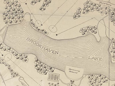
1912.1.0.0 | 17th-Fulton 18th-DeKalb | 10, 11 239,340 | Knox Thomas | Brookhaven Estates | 30"x28" | 1 in. = 225 ft. | Brookhaven Country Club and surrounding lots for sale |
1912.2.0.0 | 15th | 234, 235 | unknown | G.B. Scott | 11"x16" | 1 in. = 250 ft. | Subdivision lots for Winnona Park, includes photos |
1912.3.1.0 | 15th | 246 | Walter McCurdy Jr. | DeKalb Historical Society | 16"x21" | 1 in. = 200 ft. | Recreation of Decatur 1912 overlayed onto 1981 property boundaries |
1912.3.2.0 | 15th | 246 | Walter McCurdy Jr. | DeKalb Historical Society | 16"x21" | 1 in. = 200 ft. | Recreation of Decatur 1912 overlayed onto 1981 property boundaries |
1912.3.3.0 | 15th | 246 | Walter McCurdy Jr. | DeKalb Historical Society | 16"x21" | 1 in. = 200 ft. | Recreation of Decatur 1912 overlayed onto 1981 property boundaries |
1913.1.0.0 | 18th | 6 | O.F. Kauffman | Wilbur Kirkpatrick | 8.5"x11" | unknown | Great Lake Streets, real estate land lots |
1913.2.0.0 | 18th | 238, 239 | Charles Boyer | Fernwood Estates | 15"x16" | 1 in. = 100 ft. | Subdivision of plats in vicinity of Brookhaven Road and Peachtree Road with information on back (out of Atlanta Constitution May 4, 1913) |
1913.3.0.0 | 18th | 200, 239 | Charles Boyer | Brookhaven Heights | 16"x18" | 1 in. = 100 ft. | Subdivision of plats in vicinity of Brookhaven Road and Peachtree Road |
1913.4.0.0 | 15th | 212, 237, 238 | R.B. Railey | McKenzie Trust Co. | 23"x22" | 1 in. = 100 ft. | Lake Claire Neighborhood, shows Palifox Drive and Tuxedo Avenue |
1914.1.0.0 | 15th | 234, 2335 | C.S. Mercer | Winnona Park | 12"x22" | 1 in. = 100 ft. | Winnona Park subdivision, real estate lots, blueprint |
1914.2.0.0 | 18th-DeKalb 17th-Fulton | 108 5 | O.F. Kauffman | Woodland Hills | 24"x19" | 1 in. = 100 ft. | Subdivision plat map, Woodland Hills, vicinity of LaVista and Cheshire Bridge |
1915.1.0.0 | DeKalb (some) | N/A | Maynard, Carter, Simmons | DeKalb County | 24"x19" | unknown | Section 5 of 8 (other sections missing), comprehensive DeKalb Co map, see oversized files for full map, cadastral |
1917.1.0.0 | 16th | 73, 47, 89, 90, 125, 126 | C.S. Mercer | City of Stone Mountain | 18"x24" | unknown | Individual lot ownership, railroads, electric railway, town features, cadastral. Mounted |
1917.2.0.0 | 18th | N/A | C.S. Mercer | City of Stone Mountain | 1in. = 15 ft. | Map of the City of Stone Mountain with cadastral information. | |
1926.1.0.0 | 15th | N/A | O.F. Kauffman | Avondale Estates | 24"x33" | 1 in. = 200 ft. | General plan for units one and two of Avondale Estates with additional information on back |
1930U.1.0.0 | 18th | see abstract | unknown | unknown | 18"x40" | 1 in. = 35 ft. | Hand drawn blueprint with cadastral information Land Lots 112-114, 148-150, 159-161, 193-195, 204-206, 233-235 |
1930U.2.0.0 | 18th | 101-103 | unknown | unknown | 18"x9" | 1 in. = 35 ft. | Hand drawn blueprint with cadastral information, same surveyor as 1900U.1.0.0 |
1935.1.1.0 | Entire County | N/A | S.D. Martin (Dixie Map Corp.) | DeKalb County | 24"x30" | 1 in. = 1 mile | Official school district map, improved roads, land lots, districts, county officials' names, original paste-up |
1935.1.2.0 | Entire County | N/A | S.D. Martin (Dixie Map Corp.) | DeKalb County | 24"x30" | 1 in. = 1 mile | Official school district map, improved roads, land lots, districts, county officials' names, mylar print |
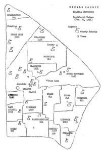
1937.1.1.0 | Entire County | N/A | S.D. Martin (Dixie Map Corp.) | DeKalb County | 24"x30" | 1 in. = 1 mile | DeKalb County map, roads, school districts, militia districts, dirt roads, schools, churches, street car lines |
1937.1.2.0 | Entire County | N/A | S.D. Martin (Dixie Map Corp.) | DeKalb County | 24"x30" | 1 in. = 1 mile | DeKalb County map, roads, school districts, militia districts, dirt roads, schools, churches, street car lines, mounted |
1940U.1.0.0 | 15th & 18th | see abstract | unknown | most likely City of Decatur | 38"x28" | 1 in. = 450 ft. | City of Decatur, cadastral information Land Lots 15th Dist.=202-204, 212-215, 244-247, 18th Dist.=4-7, 50, 51 |
1945.1.0.0 | 18th | 53 | L.H. Fitzpatrick | Mrs. M.R. Goldman | 19"x16" | 1 in. = 30 ft. | Survey of M.R. Goldman property, Emory Village |
1945.2.0.0 | Entire County | N/A | unknown | DeKalb County | 24"x30" | 1 in. = 1 mile | DeKalb County road map with index of roads and latitude and longitude |
1945.2.0.1 | Entire County | N/A | unknown | DeKalb County | 24"x30" | 1 in. = 1 mile | DeKalb County road map with index of roads and latitude and longitude |
1945.2.0.2 | Entire County | N/A | unknown | DeKalb County | 24"x30" | 1 in. = 1 mile | DeKalb County road map with index of roads and latitude and longitude |
1946.1.0.0 | Entire County | N/A | Hardie C. Bass, Jr. | DeKalb Chamber of Commerce | 13"x17" | 1 in. = 1.33 miles | Landmarks and attractions in DeKalb County |
1948.1.0.0 | Entire County | N/A | Georgia DOT | Georgia DOT | 18"x38" | 1 in. = 1 mile | DeKalb Country roads and militia districts and abundant other information in the map legend |
1950U.1.0.0 | 18th | N/A | Robert & Co. Associates | Stone Mountain Memorial Ass. | 25"x18" | 1 in. = 750 ft. | Master plan for the Stone Mountain Memorial, color |
1952.1.0.0 | Almost Entire County | N/A | unknown | unknown | 17"x22" | unknown | Postmaster's map |
1954.1.0.0 | Entire County | N/A | Georgia DOT | Georgia DOT | 18"x38" | 1 in. = 1 miles | DeKalb County roads, militia districts, and other information in the map legend |
1955.1.0.0 | Entire County | N/A | unknown | DeKalb County | 36"x27" | 1 in. = .75 miles | DeKalb County road map, Rural Road Authority project |
1956.1.0.0 | 15th & 16th | see abstract | USGS | Dept. of Interior | 22"x27" | 2.5 in. = 1 mile | Redan Quadrant, topographic, color. Land Lots: 15th=1-6, 27-38, 59-70, 91-102, 123-134, 155-166, 187-198, 16th=4-29, 36-61, 68-93, 100-125, 12th=252, 253, 228, 229 |
1956.2.0.0 | 15th, 16th, & 18th | see abstract | USGS | Dept. of Interior | 22"x27" | 2.5 in. = 1 mile | Stone Mountain Quadrant, topographic, color. Land Lots: 15th=193-198, 219-230, 251-256, 16th=1-3, 30-35, 62-67, 94-99, 18th=11-23, 33-45, 66-78, 85-97, 118-130, 132-144, 165-176, 178-189, 210-229, 250-264 |
1956.3.0.0 | 11th & 16th | see abstract | USGS | Dept. of Interior | 22"x27" | 2.5 in. = 1 mile | Conyers Quadrant, topographic, color. Land Lots: 11th=216-217, 232-234, 247-249, 16th=113-125, 132-157, 164-189, 196-203, 216-221, 228-230, 252, 253, 257 |
1956.4.0.0 | 16th & 18th | see abstract | USGS | Dept. of Interior | 22"x27" | 2.5 in. = 1 mile | Snellville Quadrant, topographic, color. Land Lots: 16th=126-131, 158-163, 190-195, 222-227, 254, 256, 18th=24-32, 79-84, 131 |
1957.1.0.0 | Entire County | N/A | George Simmons Jr. | DeKalb Chamber of Commerce | 28"x18" | unknown | High schools and water systems |
1960U.1.0.0 | 15th | N/A | unknown | unknown | 22"x27" | unknown | 42nd Senatorial District, shows DeKalb County school districts. |
1960U.2.0.0 | Entire County | N/A | Dept. of High School Teachers | DeKalb County | 18.5"x 22" | unknown | Map of major roads in DeKalb County with 126 places of interest to visit. |
1960.1.0.0 | Entire County | N/A | State Highway Dept. | DeKalb County | 22"x35" | 1 in. = 1 mile | General Highway map of DeKalb County with incorporated city information, shows major landmarks |
1960.1.1.0 | Entire County | N/A | State Highway Dept. | DeKalb County | 22"x35" | 1 in. = 1 mile | General Highway map of DeKalb County with incorporated city information, shows major landmarks |
1960.1.2.0 | Entire County | N/A | State Highway Dept. | DeKalb County | 22"x35" | 1 in. = 1 mile | General Highway map of DeKalb County with incorporated city information, shows major landmarks, includes highlighted creek beds |
1960.2.0.0 | Almost Entire County | N/A | Georgia DOT | DeKalb County | 18"x36" | 1 in. = 1 mile | General Highway map of DeKalb County with incorporated city information, shows major landmarks, does not include the eastern part of the county |
1962.1.1.0 | Entire County | N/A | unknown | DeKalb County | 26"x26" | 1 in. = 5000 ft. | District and land lot base map for entire county, also shows outlined incorporated townships. |
1962.1.2.0 | Entire County | N/A | unknown | DeKalb County | 26"x26" | 1 in. = 5000 ft. | District and land lot base map for entire county, also shows outlined incorporated townships. |
1962.1.3.0 | Entire County | N/A | unknown | DeKalb County | 26"x26" | 1 in. = 5000 ft. | District and land lot base map for entire county, also shows outlined incorporated townships. |
1962.1.4.0 | Entire County | N/A | unknown | DeKalb County | 26"x26" | 1 in. = 5000 ft. | District and land lot base map for entire county, also shows outlined incorporated townships. |
1962.1.5.0 | Entire County | N/A | unknown | DeKalb County | 26"x26" | 1 in. = 5000 ft. | District and land lot base map for entire county, also shows outlined incorporated townships. |
1965.1.0.0 | Entire County | N/A | Georgia DOT | DeKalb County | 22"x28" | 1 in. = 1 mile | DeKalb County general highway map with incorporated townships and landmarks, also has insets of area near Stone Mountain and I285 construction in South DeKalb. |
1965.1.1.0 | Entire County | N/A | Georgia DOT | DeKalb County | 22"x34" | 1 in. = 1 mile | DeKalb County general highway map with incorporated townships and landmarks, also has insets of area near Stone Mountain and I285 construction in South DeKalb. |
1965.1.2.0 | Entire County | N/A | Georgia DOT | DeKalb County | 22"x34" | 1 in. = 1 mile | DeKalb County general highway map with incorporated townships and landmarks, also has insets of area near Stone Mountain and I285 construction in South DeKalb. |
1965.2.0.0 | Entire County | N/A | DeKalb Public Works | DeKalb County | 34.25"x 44.5" | 1 in. = 3000 ft. | DeKalb County road system, folded map showing major roads and townships. |
1967.1.0.0 | 16th | 28 | Mapco, Inc. | DeKalb County | 32"x26" | 1 in. = 200 ft. | Topographic map of a land lot northeast of Lithonia in the 16th district, Old Biffle Cabin site topographic |
1967.2.0.0 | 18th | 42 | Julian Swain | James King | 27.5"x 22.25" | 1 in. = 50 ft. | Plat map of Flintridge Forest subdivision |
1967.3.0.0 | 15th | 95 & 96 | Mapco, Inc. | DeKalb County | 30"x20" | 1 in. = 200 ft. | Topographic map of land lots along Snapfinger Road in the 15th district. |
1967.4.0.0 | Several Counties | N/A | unknown | Atl. Metro Planning Commission | 43"x41" | 1 in. = 8000 ft. | Map made for planning, shows entire DeKalb County with parts of surrounding counties. Shows Atlanta regional development patterns. |
1967.5.0.0 | Entire County | N/A | DeKalb Co. Dept. of Planning | DeKalb County | 1 in. = 3000 ft. | Map of entire county with major roads, districts, land lots, shows Board of Education Electoral Districts. | |
1967.6.0.0 | Entire County | N/A | US Army Corps of Engineers | US Government | 16"x 10.5" | 1 in. = 440 ft. | Collection of topographic maps showing DeKalb and Fulton Counties, shows flood projections, houses, and other landmarks. |
1968.1.1.0 | Entire County | N/A | DeKalb Co. Dept. of Planning | DeKalb County | 1 in. = 4000 ft. | Map of entire county with major roads, districts, land lots, shows Senate and Commissioner Districts in DeKalb. | |
1968.1.2.0 | Entire County | N/A | DeKalb Co. Dept. of Planning | DeKalb County | 1 in. = 4000 ft. | Map of entire county with major roads, districts, land lots, shows Senate and Commissioner Districts in DeKalb. | |
1968.2.0.0 | 15th | 132 & 157 | Julian Swain | Cocal, Inc. | 27.5"x 22.25" | 1 in. = 1000 ft. | Plat map of Emerald North subdivision. |
1968.3.0.0 | Entire County | N/A | Dept. of Planning | DeKalb County | unknown | Map of existing anf proposed DeKalb County parks overlayed onto land lot and district base road map. | |
1968.4.0.0 | Entire County | N/A | Dept. of Planning | DeKalb County | 1 in. = 3000 ft. | Map of DeKalb Senatorial districts overlayed onto base road map. | |
1969.1.0.0 series | Entire County | N/A | Georgia DOT | DeKalb County | unknown | Collection of 17 maps dividing DeKalb County and showing road conditions as of 1969 throughout the county. | |
1969.2.0.0 | 18th | 212, 213, 226, 227 | unknown | unknown | 1 in. = 200 ft. | Plat map of indicated land lots in the Tucker area. | |
1969.3.0.0 | 18th & 6th | 371 (18th) 307, 308, 310, 311 | unknown | unknown | 1 in. = 200 ft. | Plat map of indicated land lots east of Dunwoody. | |
1970U.1.0.0 | 15th | 245 | unknown | DeKalb Historical Society | 11"x17" | 1 in. = 30 ft. | Detailed site plat map of area surrounding the Swanton House in Decatur. |
1970U.2.0.0 | 15th & 18th | 239-244, 2, 3 | unknown | Fernbank | 24"x20" | unknown | Map of Fernbank's property holdings with proposed acquisitions highlighted. |
1970U.3.0.0 | 15th & 16th | N/A | unknown | unknown | unknown | Detailed road base map of the southern half of DeKalb County, with some cadastral information. | |
1970U.4.0.0 | Entire County | N/A | unknown | unknown | unknown | Enlarged map of DeKalb County, details the location of 362 churches in the county. | |
1970.1.0.0 | 18th | 37-39, 72-75, 88-91, 124-126 | Georgia DOT | DeKalb County | 36"x26" | 1 in. = 660 ft. | Road map of the City of Stone Mountain, shows streets denoting Federal aid systems, state and US roads, legend show many points of interest. |
1970.2.0.0 | 18th | 66 ,67, 96-98, 118, 119 | Georgia DOT | DeKalb County | 1 in. = 660 ft. | Road map of the City of Clarkston, shows streets denoting Federal aid systems, state and US roads, legend show many points of interest. | |
1970.3.0.0 | Entire Atlanta Region | N/A | Thomas M. Lowe, Jr. | unknown | 1 in. = 8000 ft. | Atlanta Regional Photo map, divides entire region into corresponding photos (not included). | |
1970.4.0.0 | 16th | 135-136, 152-154, 167-169 | Georgia DOT | DeKalb County | 1 in. = 660 ft. | Road map of the City of Lithonia, shows streets denoting Federal aid systems, state and US roads, legend show many points of interest. | |
1970.5.0.0 | 18th | 40-41 | Georgia DOT | DeKalb County | 1 in. = 660 ft. | Road map of the City of Pine Lake, shows streets denoting Federal aid systems, state and US roads, legend show many points of interest. | |
1970.6.0.0 | 18th | 296, 297, 310 ,311, 321, 322, 335-337 | Georgia DOT | DeKalb County | 1 in. = 660 ft. | Road map of the City of Doraville, shows streets denoting Federal aid systems, state and US roads, legend show many points of interest. | |
1971.1.0.0 | 18th & 15th | 4-7, 203-205, 212-215, 234-237, 244-249 | Georgia DOT | DeKalb County | 1 in. = 660 ft. | Road map of the City of Decatur, shows streets denoting Federal aid systems, state and US roads, legend show many points of interest. | |
1971.2.0.0 | 18th | 278-281, 297-300, 307-309 | Georgia DOT | DeKalb County | 1 in. = 660 ft. | Road map of the City of Chamblee, shows streets denoting Federal aid systems, state and US roads, legend show many points of interest. | |
1971.3.0.0 | 15th | 49-50, 79-83 | Georgia DOT | DeKalb County | 1 in. = 660 ft. | Road map of the City of Constitution, shows streets denoting Federal aid systems, state and US roads, legend show many points of interest. | |
1971.4.1.0 | Entire County | N/A | Georgia DOT | DeKalb County | 1 in. = 1 mile | DeKalb County general highway map with other general information about DeKalb county. | |
1971.4.2.0 | Entire County | N/A | Georgia DOT | DeKalb County | 1 in. = 1 mile | DeKalb County general highway map with other general information about DeKalb county. | |
1972.1.0.0 | Entire County | N/A | Dept. of Planning | DeKalb County | 1 in. = 3000 ft. | DeKalb County voting precincts overlayed onto base road system map. Sun has bleached the left side of the map. | |
1976.1.0.0 | N.E. Corner of County | N/A | Georgia DOT | DeKalb County | 1 in. = 4000 ft. | Atlanta and vicinity road and highway map. Only depicts a small section of DeKalb. | |
1976.2.0.0 | unknown | unknown | unknown | unknown | 1 in. = 40 feet | Topographic map of the McGarity-Etheridge site on Soapstone Ridge. | |
1977.1.0.0 | 15th | 245 | Beverly Jordan | DHS | 1 in. = 8 feet | Detailed site plan for the Swanton House and kitchen. Contains both site map and landscape drawing. | |
1978.1.1.0 | 18th | 214 | R.F.C. | unknown | 1 in. = 40 feet | Site plan for proposed Browning Courthouse and recreation area near Tucker. | |
1978.1.2.0 | 18th | 214 | R.F.C. | unknown | 1 in. = 40 feet | Site plan for proposed Browning Courthouse and recreation area near Tucker. | |
1980.1.1.0 | Entire County | N/A | Dept. of Planning | DeKalb County | 1 in. = 3000 ft. | DeKalb County road map, shows paved, unpaved, and private roads. | |
1980.1.2.0 | Entire County | N/A | Dept. of Planning | DeKalb County | 1 in. = 3000 ft. | DeKalb County road map, shows paved, unpaved, and private roads. | |
1980.1.3.0 | Entire County | N/A | Dept. of Planning | DeKalb County | 1 in. = 3000 ft. | DeKalb County road map, shows paved, unpaved, and private roads. | |
1982.1.0.0 | Entire County | N/A | Georgia DOT | DeKalb County | 1 in. = 1 mile | DeKalb County general highway map. | |
1983.1.0.0 | Entire County | N/A | Dept. of Planning | DeKalb County | 1 in. = 2300 ft. | DeKalb County general highway map, Georgia road system. | |
1984.1.0.0 | Entire County | N/A | Dept. of Planning | DeKalb County | 1 in. = 3000 ft. | DeKalb County general highway map, Georgia road system. | |
1985.1.0.0 | Entire County | N/A | Dept. of Planning | DeKalb County | 1 in. = 2300 ft. | DeKalb County general highway map, Georgia road system. | |
1986.1.0.0 | Entire County | N/A | Dept. of Planning | DeKalb County | 1 in. = 2300 ft. | DeKalb County general highway map, Georgia road system. | |
1987.1.0.0 | Entire County | N/A | Dept. of Planning | DeKalb County | 1 in. = 3000 ft. | DeKalb County general highway map, Georgia road system. | |
1988.1.0.0 | Entire State | N/A | Georgia DOT | Georgia DOT | 1 in. = 14.4 miles | Georgia state map with tourist information on the back, also depicts smaller city maps on reverse side. |