“Shady Lawn,” Mystery Home in East Lake
The location and story of “Shady Lawn,” a home in the East Lake neighborhood remained a mystery.
By Marissa Howard, Programs and Membership Coordinator
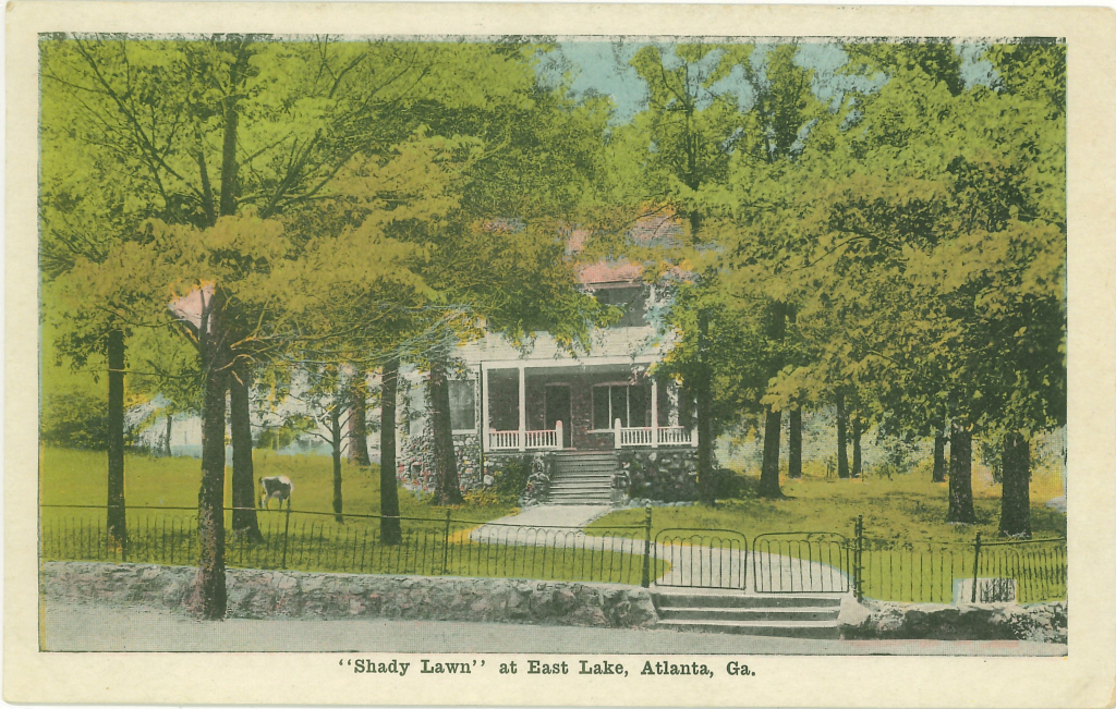
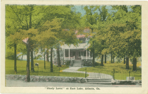
One could easily view this postcard and move along; it’s just another house in East Lake lost to time.
Most of it is obscured, but you can identify a few features. The home’s first story is made of stone, possibly granite. There is a bay window on the front – or is it a tower? The roof doesn’t appear to be hipped but rather side-gabled. The upper floor has a different texture and looks like shingles.
My best guess is that this is a Shingle Style home; a rare style in Georgia. Shingle Style, which began in the northeast, is often associated with seaside locations. For a few more Georgia examples, you can look to the historic district on Jekyll Island. Often called a “cottage with shingles,” this style would have fit in well with the architecture found in East Lake where a majority of the homes were built between 1870 and 1900.
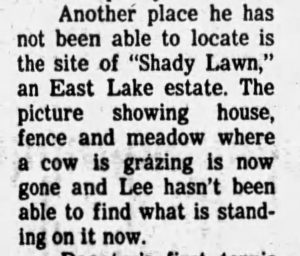
This postcard is part of the Joe Lee Collection, in the archives of the DeKalb History Center. Joe Lee, III, was a historian, author, and collector of historic postcards and other ephemera. In a newspaper article from 1983, he discussed his massive collection and his quest to identify many of the images. One postcard remained a mystery, “Shady Lawn.”
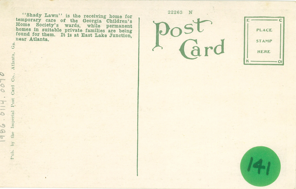
Not wanting to pass up a good history mystery, I dug around and found the answer. The first clue was printed on the back of the postcard:
“Shady Lawn … Georgia Children’s Home … is at East Lake Junction.”
I have been researching other homes in the East Lake area and many have quaint nicknames. The problem I encountered was that Shady Lawn is not only a generic moniker but also a descriptor. Typing “Shady Lawn” into a newspaper search will turn up hundreds of hits for the phrase shady lawn.
Instead, I searched “Georgia Children’s Home.” The Georgia Children’s Home Society was an organization, founded in 1911 that was dedicated to finding new residences for children without homes. In 1916, the organization needed “receiving homes” to temporarily house children until they could find a permanent home.
In May 1919, the Society purchased Shady Lawn. “A real home, with a big yard, large shade trees, and a barn for a cow-only there is no cow.” The newspaper printed an appeal which showed a small boy asking for someone to donate a cow so the home would have “an abundant milk supply.”
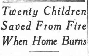
The home officially opened in July of 1919, with plenty of room for the children. Four months later, on December 10, 1919, at 6:00 pm, a fire erupted in the home. The furniture and property were destroyed, but thankfully all 20 children safely escaped the blaze.
All of the older children were downstairs at dinner when the fire began. The caretaker, Mrs. Euge was in the nursery and heard falling coals from above the ceiling of the second floor. Mrs. Euge later went on to say, “The reason that I didn’t discover the fire before I did was the children were so happily laughing and romping that it took an exceptional noise to attract attention.”
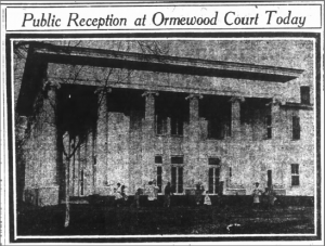
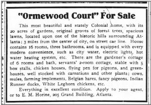
It is unclear what caused the fire and how bad it was. However, one December article said that the Society hoped to begin rebuilding in January. After that, I couldn’t find any more mention of Shady Lawn. During this same time, the Georgia Children’s Home Society purchased a second and much larger mansion “Ormewood Court” near Grant Park.
The mansion carried a monthly mortgage of $12,000. It appeared that the Georgia Children’s Home Society put all of their efforts toward this one home rather than rebuilding in East Lake.
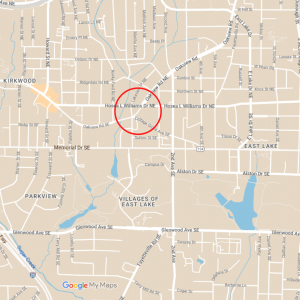
I thought this was the end of Shady Lawn. It had burned – presumably to the ground – in 1919. But I just couldn’t let it go, I had to know exactly where it had been located. From the postcard and newspaper clippings, the location is known as East Lake Junction.
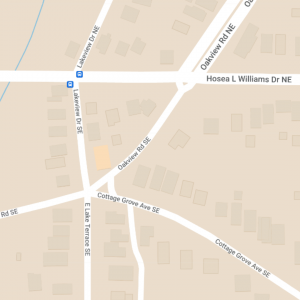
East Lake Junction is the intersection of Oakview Road, East Lake Terrace SE, Lakeview Drive NE, and Cottage Grove Avenue SE. It was the intersection of the South Decatur Trolley Car line and the East Lake Line. A plat map from 1913 shows the trolley stop at the intersection.
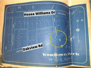
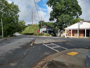
Should I end my search now? After all, Shady Lawn burned in 1919. Curiosity urged me on. My next step was to check our collection of city directories. Were there any homes listed in the directory in 1918 or 1919? Unfortunately, no. The location in question was in the City of East Lake. Until 1928, East Lake was an independent city, not yet incorporated into Atlanta, and not represented in those City Directories.
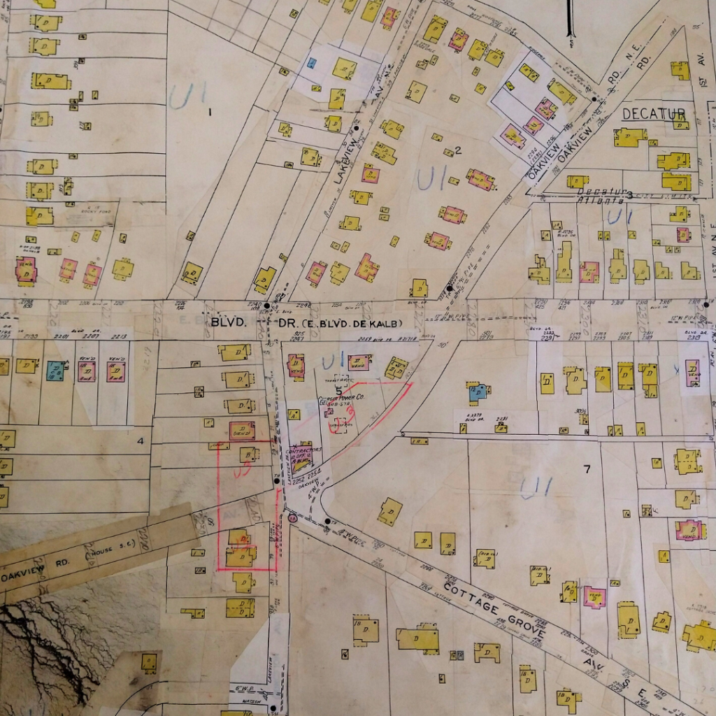
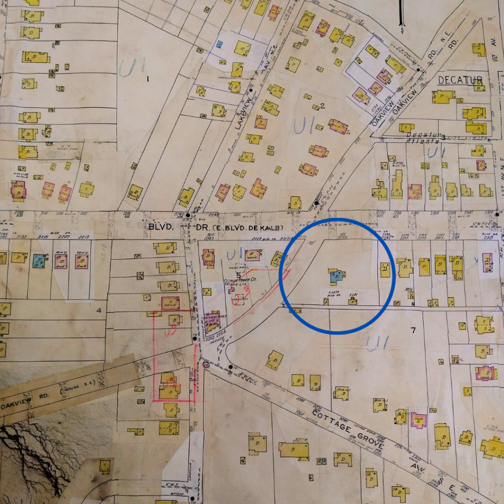
Next, I turned to our Sanborn Map. Sanborn Maps were created for fire insurance purposes and show buildings and their construction materials. The Sanborn maps we have in our collection are from 1924, however, they were updated throughout the years. Often, even if a building has been demolished, you can still see evidence of it under the updates. The updates to our maps after 1924 were literally done by cut and paste.
I started to study this map. The colors of the houses depict the different materials used in construction. A wood frame house is yellow. Brick will be in pink. But do you see another color building with a “D” for dwelling? Blue is for stone. As in a stone house.
Remember the postcard?
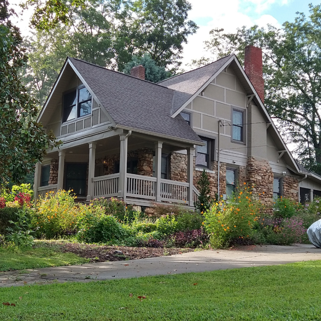
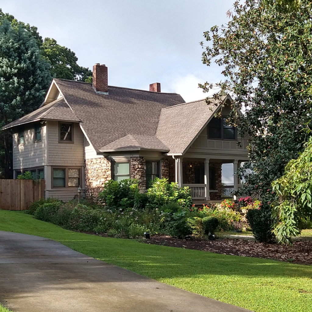
Here it was at 2279 Hosea Williams Drive, today considered the Kirkwood neighborhood. And from the front, I could see the unmistakable stone bay window. I can’t believe it. Shady Lawn survived and was rebuilt, but no longer has shingles on the second story. Tax records indicate this house is from 1900, which while not always accurate, definitely could fit the profile of Shady Lawn.
From the street view, the curving sidewalk of the postcard era Shady Lawn is still present in the driveway. The asymmetrical placement of the fireplaces also verifies the age of the home.
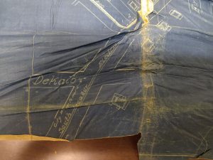
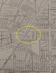
Plat map of East Lake Park Subdivision, 1912. The map has had some damage and folding, but you can see Shady Lawn at the bottom. The house is on the southeast corner of the intersection of Boulevard DeKalb (now Hosea Williams Drive) and the South Decatur Trolley Line.
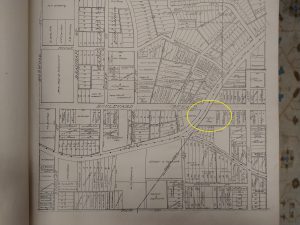
1915 Plat Ownership Map. Larger area and zoomed in.
The earliest map we have that shows land ownership is from 1915. The property was owned by Schaul and May who were business partners from 1900 to 1911, and ran a successful jewelry business together. Henry Schaul also had a real estate business. It is unclear if this was an investment property or summer home.
The home was rebuilt at an undetermined time after the fire of 1919. The earliest occupants post fire were in 1927.
The discovery of this property and location is one of historian’s luck.


